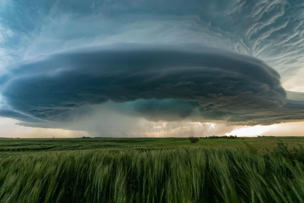
Supercell tornado prediction has become simultaneously better and worse. Radar technology, computing power, and scientific understanding have all advanced dramatically since the 1990s. Yet the fundamental problem remains stubbornly resistant to solution: tornadoes can be predicted only to a limited extent, and forecasters still cannot reliably distinguish which rotating storms will produce them.[s]
The Core Problem with Supercell Tornado Prediction
Supercells are severe, long-lived organized thunderstorms. They rotate, can persist for more than an hour, and can produce large and violent tornadoes.[s] But here is the paradox: while forecasters can often identify supercells, predicting which ones will spawn tornadoes remains an unsolved problem in atmospheric science.
The reason lies in how low-level rotation forms. According to a 2025 review in the Journal of Meteorological Research, the horizontal vorticity that creates a tornado derives from two distinct mechanisms: vertical wind shear in the boundary layer and baroclinicity generated by the storm’s own gust front.[s] Which mechanism dominates in any given storm remains unknown. This is not a minor gap; it is the central unsolved question in supercell tornado prediction.
Vertical wind shear occurs when wind speed or direction changes with altitude. Baroclinicity refers to temperature differences that create pressure gradients. Both can tilt horizontal rotation into vertical rotation. Both can intensify mesocyclones. But their relative contributions vary from storm to storm, and forecasters have no reliable way to measure them in real time.
Why Supercells Refuse to Follow the Rules
Environmental conditions that favor supercell development are reasonably well understood. High convective available potential energy provides the fuel. Strong vertical wind shear organizes the storm and allows it to persist. Storm relative helicity indicates rotation potential. Forecasters can measure these parameters and issue tornado watches when they align favorably.
But tornado watches cover enormous areas because the atmosphere’s sensitive dependence on initial conditions makes precise localization impossible. A tornado might form in one county while another county under the same watch sees nothing. The problem is not that forecasters misread the environment; the problem is that micro-scale interactions between the storm and its surroundings determine whether tornadogenesis actually occurs.
The mechanisms that maintain and enhance mesocyclones are complex and vary across different scenarios, particularly when storms embed in heavy precipitation, merge with other cells, or approach surface boundaries like fronts and drylines.[s] Each interaction can either strengthen or weaken the rotation in ways models cannot yet predict.
The QLCS Problem: A Quarter of All Tornadoes
Quasi-linear convective systems account for approximately a quarter of all tornado events in the United States, yet no field campaigns focused specifically on understanding their tornadogenesis until PERiLS.[s] The PERiLS field phases spanned late winter and early spring of 2022 and 2023, and the project was the first dedicated observational study of tornadoes associated with QLCSs.
QLCS tornadoes develop within mesovortices, small rotating segments along a squall line. The challenge is that not all mesovortices become tornadic, and forecasters struggle to distinguish the dangerous ones from the harmless ones. Tornadic mesovortices tend to have stronger rotational velocities and smaller diameters than non-tornadic ones.[s] They also contract in the minutes before tornadogenesis, a potential warning signal, but one that requires extremely rapid radar updates to detect.
Nighttime tornadoes create a separate warning problem: they are hard to see, and warnings may not wake residents in time. A Weather and Forecasting study found that nocturnal tornadoes were almost twice as likely to kill as daytime tornadoes from 1950 to 2005.[s]
The Paradox of Declining Major Tornadoes
Here is a counterintuitive trend: major tornadoes have become rarer even as our ability to detect weaker ones has improved. The 1975-1984 decade averaged 49 F/EF3+ tornadoes per year; the 2015-2024 decade averaged only 26 per year, a decline of roughly 46 percent.[s]
Some of this decline may be artifactual. The Enhanced Fujita scale introduced in 2007 changed rating methodology, and better warnings may reduce damage markers that drive intensity ratings. But there is no evidence of an increase in major tornado incidence, and there are physical hypotheses for an actual decrease.
Arctic amplification, the faster warming of polar regions, may weaken lower-tropospheric wind shear by reducing the temperature gradient between the equator and poles. This would make the atmosphere less favorable for supercell formation.[s] If true, supercell tornado prediction could become easier in a warming world, but only because there are fewer supercells to predict.
Geographic Shift and Its Consequences
Tornado activity has shifted eastward from the traditional Tornado Alley into the Southeast.[s] This shift moves tornadoes into more populated areas where manufactured housing offers less protection[s] and nocturnal events can make warning response harder.[s]
Climate modeling in Europe projects an 11 percent increase in supercell occurrence under a 3 degree warming scenario, with strong increases in central and eastern Europe.[s] But standard proxy analyses based on instability and wind shear often fail to capture the effects of complex terrain.[s] Mountains alter wind profiles and moisture distribution in ways that coarse models miss.
The Observation Gap
Improved supercell tornado prediction requires better observations in the atmospheric boundary layer, the lowest kilometer of the atmosphere where tornadic vorticity originates. But there is a critical lack of observations of basic meteorological parameters in the boundary layer, and this gap limits forecasting skill.[s]
Doppler radar sees storms well, but it struggles to capture the subtle temperature and moisture gradients near the surface that determine whether a mesocyclone will reach the ground. Radiosondes provide vertical profiles but only at scattered locations and times. Surface stations miss the vertical structure. Satellites see cloud tops, not what happens beneath them.
False Alarms and Public Response
Even if forecasters could predict tornadoes more accurately, there is a downstream problem: repeated false alarms can erode warning response. High false alarm rates lead to cry-wolf syndrome, where past warnings that did not produce the expected impacts reduce compliance with future warnings.[s]
Paradoxically, longer lead times can reduce protective action. People who receive warnings well in advance tend to engage in “milling” behavior, seeking additional information and confirmation rather than immediately sheltering.[s] The improvements in lead time that meteorologists have achieved may not translate to saved lives if the public does not respond appropriately.
What Would Solve This
Three advances would materially improve supercell tornado prediction. First, understanding which low-level vorticity mechanism dominates under which conditions would allow forecasters to focus on the right environmental signals. Second, dense boundary layer observations from drones, phased array radars, or profiler networks would capture the micro-scale interactions that determine tornadogenesis. Third, reducing false alarm rates would restore public trust in warnings.
None of the three is a simple near-term fix. The atmosphere is not merely complex; it is chaotic in the mathematical sense. Small measurement errors compound exponentially. In 2023, U.S. insured losses from severe convective storms reached a record 58 billion dollars, underscoring the economic stakes of prediction limits.[s]
The Vorticity Generation Problem in Supercell Tornado Prediction
The fundamental obstacle to supercell tornado prediction lies in the generation of low-level vertical vorticity. Unlike mid-level mesocyclones, which form through straightforward tilting of environmental horizontal vorticity by storm updrafts, the vorticity responsible for tornadogenesis has multiple potential sources with competing dynamics.
A comprehensive 2025 review synthesized the state of the research: the horizontal vorticity contributing to the low-level mesocyclone derives from two distinct mechanisms, namely environmental vertical shear in the boundary layer and gust front-induced baroclinicity. Which mechanism is more dominant remains unclear.[s]
Environmental vertical shear produces streamwise horizontal vorticity that enters the updraft and tilts into the vertical. This mechanism depends on the near-storm wind profile, particularly in the lowest 500 meters. Gust front baroclinicity, by contrast, generates horizontal vorticity in situ through temperature gradients across the storm’s outflow boundary. This vorticity can be tilted and stretched into tornado-scale rotation.
The relative importance of these mechanisms varies with storm mode, environmental shear profile, boundary layer thermodynamics, and interactions with external features. The mechanisms that maintain and enhance mesocyclones are complex and vary across different scenarios, particularly when embedded within heavy precipitation, during storm mergers, or in proximity to surface mesoscale boundaries.[s]
Distinguishing Parameters: SRH, LCL, and the 0-500m Layer
Buoyancy instability is a necessary ingredient in the supercell’s environment, whereas dynamic factors such as vertical wind shear and low-level storm relative helicity are more sensitive parameters for distinguishing supercells from non-supercells.[s] But distinguishing tornadic from non-tornadic supercells requires examining finer-scale parameters.
The 0-500m fixed-layer storm relative helicity has emerged as a discriminating variable, along with lifting condensation level height and effective storm relative helicity. Low LCL heights correlate with tornadic supercells because they reduce the depth of the subcloud layer where evaporative cooling can weaken rotation. But these parameters have significant overlap between tornadic and non-tornadic populations.
The sensitive dependence on initial conditions inherent to atmospheric dynamics means that even perfect environmental measurements cannot fully determine outcomes. Two supercells in identical environments can have different fates based on microscale vorticity interactions invisible to the observational network.
QLCS Mesovortex Dynamics and the PERiLS Dataset
Quasi-linear convective systems produce approximately 25 percent of U.S. tornado events, but prior to PERiLS (2022-2023), no field campaigns had focused specifically on collecting data to understand QLCS tornadogenesis.[s]
The central challenge in QLCS tornado prediction is mesovortex discrimination. Not all mesovortices are tornadic, yet pre-tornadic rotational velocities overlap with non-tornadic values. PERiLS data showed that tornadic mesovortices had stronger Vrots, smaller diameters, and slightly longer lifetimes compared to wind-damaging and non-damaging mesovortices.[s]
Critically, tornadic mesovortices contracted in the minutes leading up to tornadogenesis. This contraction signature could benefit nowcasters, but detecting it requires temporal resolution finer than standard WSR-88D volume coverage patterns provide. Several mesovortices visible at the lowest WSR-88D elevation scans were not observed in COW radar data, indicating vertical structure variations that complicate detection.
Data Artifacts and Trend Detection
The observational record itself complicates supercell tornado prediction research. Storm Prediction Center reports contain non-physical artifacts due to evolving technologies, reporting practices, and population density.[s] Doppler radar deployment in the 1990s increased detection of weaker tornadoes. Population growth changed reporting probability spatially. The Enhanced Fujita scale altered intensity classification.
Despite these limitations, synthetic event sets derived from Global Ensemble Forecast System reforecasts show robust signals. The GEFS synthetic event set shows higher outbreak activity during La Nina conditions and increased outbreak activity during 2010-2019 compared to 2000-2009, consistent with reports.[s] Return level analysis indicates that the 1-in-100-year U.S. tornado outbreak produces 150-250 F/EF1+ tornadoes per day.
Normalized tornado loss data show a different pattern: the 1975-1984 decade averaged 49 F/EF3+ tornadoes annually; the 2015-2024 decade averaged 26, a decline of roughly 46 percent.[s] The hypothesis that Arctic amplification weakens lower-tropospheric wind shear would explain reduced supercell favorability.[s]
Terrain Complications and Proxy Failure
Kilometer-scale climate simulations over Europe reveal an 11 percent increase in supercell frequency under +3 degrees C warming, with spatial redistribution toward central and eastern Europe.[s] But these projections expose a methodological problem: analyses of proxy environments consisting of instability and wind shear often fail to capture the effects of complex terrain.[s]
Topography facilitates supercell development and intensification by locally increasing low-level shear and moisture.[s] Orographic processes dominate convection initiation mechanisms in mountainous regions, as opposed to synoptic-scale processes like fronts over flat terrain.[s] Standard composite parameters derived from plains environments may mischaracterize risk in complex terrain.
The Boundary Layer Observation Deficit
The lack of observations of basic meteorological parameters in the boundary layer and in complex terrain is a critical limitation to advancing forecasting and nowcasting skill.[s]
Tornado forecasting requires the precise, micro-scale phasing of kinematic and thermodynamic variables.[s] A season is not defined by the average flow but by specific, often chaotic, intersections of these variables. Current observational networks cannot resolve these intersections. Radiosondes provide point samples at 12-hour intervals. Surface mesonets miss vertical structure. Doppler radar struggles with ground clutter in the lowest few hundred meters where tornadogenesis occurs.
The Spring Predictability Barrier compounds seasonal forecasting difficulties. Dynamic models struggle to forecast ENSO evolution during March and April, precisely when severe weather activity peaks.[s]
Warning Efficacy and Public Response Coupling
Meteorological improvements in supercell tornado prediction must couple with effective public response to reduce fatalities. High false alarm ratios can undermine this coupling. A high FAR leads to more instances of cry-wolf syndrome, and advancing meteorological knowledge to improve forecast accuracy would reduce false alarms and maintain public trust.[s]
But there is a lead-time paradox: increased warning times can lead to complacency and milling behavior that delays protective action.[s] Past experiences with false alarms raise the threshold for taking shelter. If individuals have experienced too many instances where warnings did not produce expected impacts, they are less likely to quickly engage in future warnings regardless of lead time.[s]
Nocturnal tornado vulnerability amplifies these concerns. The American South has a higher nocturnal tornado vulnerability, and nocturnal tornadoes were almost twice as likely to kill as daytime tornadoes in a 1950-2005 analysis because residents may be asleep, warnings are less likely to be received, and visual confirmation is harder.[s]
Synthesis: Structural Barriers to Prediction Improvement
Supercell tornado prediction faces barriers at multiple scales. At the physical level, two vorticity generation mechanisms compete without clear dominance criteria. At the observational level, boundary layer data gaps preclude resolution of tornado-scale processes. At the predictability level, the Spring Predictability Barrier and chaotic dynamics impose fundamental limits. At the societal level, false alarm history degrades warning response.
U.S. insured losses from severe convective storms reached a record 58 billion dollars in 2023 alone.[s] The number underscores the economic stakes of improving prediction and warning response.